


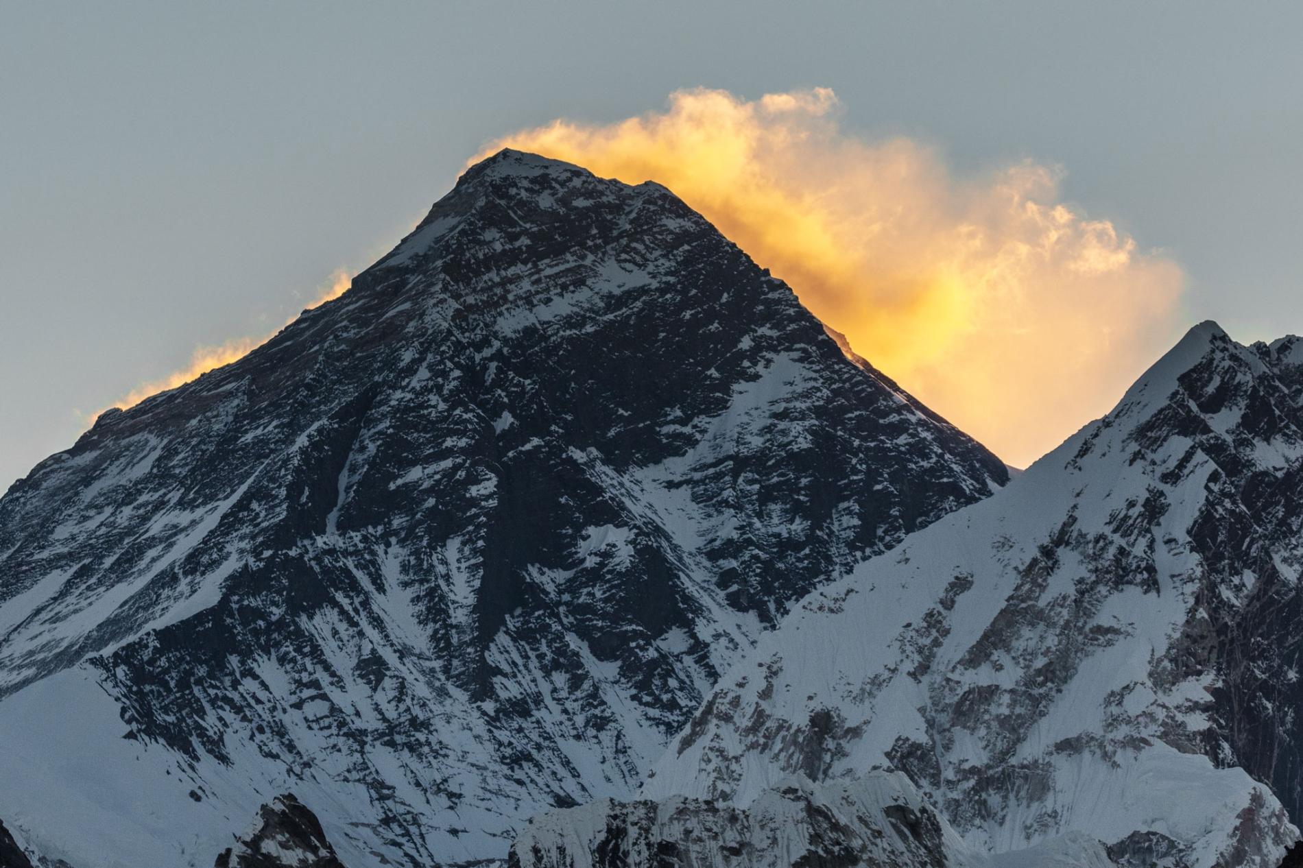
Everest Keep changing its height


The highest point on Earth has a newly announced elevation. Mount Everest is 29,031.69 feet above sea level, according to survey results presented today. That is more than two feet higher than the altitude previously recognized by the government of Nepal.
The elevation, which was announced on December 8 in a joint statement by the Survey Department of Nepal and Chinese authorities, is the culmination of a multiyear project to definitively measure the legendary mountain. As the first serious survey of Everest in 16 years, the effort has been closely followed by the geographic community—particularly scientists analyzing how a devastating 7.8 magnitude earthquake in 2015 affected the region.
Last spring a small group of Nepalese surveyors and guides endured the biting cold of a nighttime ascent, reaching the top at 3 a.m. local time so they could conduct their work unimpeded by crowds of recreational climbers, to try to settle the matter.
“We want to deliver the message that we can do something with our own [country’s] resources and technical manpower,” Khimlal Gautam, chief survey officer for the project, told National Geographic last year.
Technological peaks
In 1856, mathematician Radhanath Sickdhar found that Everest is the highest mountain in the world while he was working for the Great Trigonometrical Survey, a project dedicated to surveying and mapping the Indian subcontinent. Since then, a handful of surveys have sought to pin down the mountain’s true height with the best technology available at the time.
Until the advent of satellites, surveyors used a device called a theodolite, a precision optical instrument mounted on a tripod, for measuring angles between two designated points. Lugging their heavy equipment from hilltop to hilltop, a survey team would incrementally measure Everest’s height from sea level, zig-zagging north from the Bay of Bengal until they could see the peak.
A 1954 survey using a similar technique calculated that Everest stands at 29,028 feet above sea level, a number that is still recognized by many countries and map publishers.


Then in 1999 a survey led by cartographer and explorer Bradford Washburn, and sponsored by the National Geographic Society, was the first to use GPS technology to measure the Everest summit. That team’s work delivered an altitude of 29,035—the figure still in use by the Society until the new measurements can be fully verified.
Mounting excitement
To make their new survey as complete as possible, the Nepalese team decided to employ both techniques. On May 22, 2019, Gautam summited Everest with four teammates and deployed a GPS receiver, along with ground-penetrating radar to measure the depth of the snow piled on top of the rock. Meanwhile, teams of surveyors waited at eight sites with views of Everest’s summit to fix its elevation at sunrise, when the atmosphere is most clear, with modern laser theodolites.
But after the Survey Department of Nepal completed its field work last year, the project became mired in international politics. During Chinese President Xi Jinping’s state visit to Nepal in October 2019, officials announced that the two countries would cooperate in re-surveying the mountain, delaying the revelation of the new height. A team of Chinese surveyors were at work on the north side of the mountain this spring measuring the summit using China’s network of Beidou satellites, a rival to the GPS system.
Now that the results have been announced, representatives from both countries expressed extreme confidence in the new altitudes. But Gautam is quick to point out that no matter how accurate, every survey comes with some margin for error. “In survey mapping, we can’t find the exact point or altitude,” he says. “We’re trying to find the MPV: most probable value.
Source: National Geographic
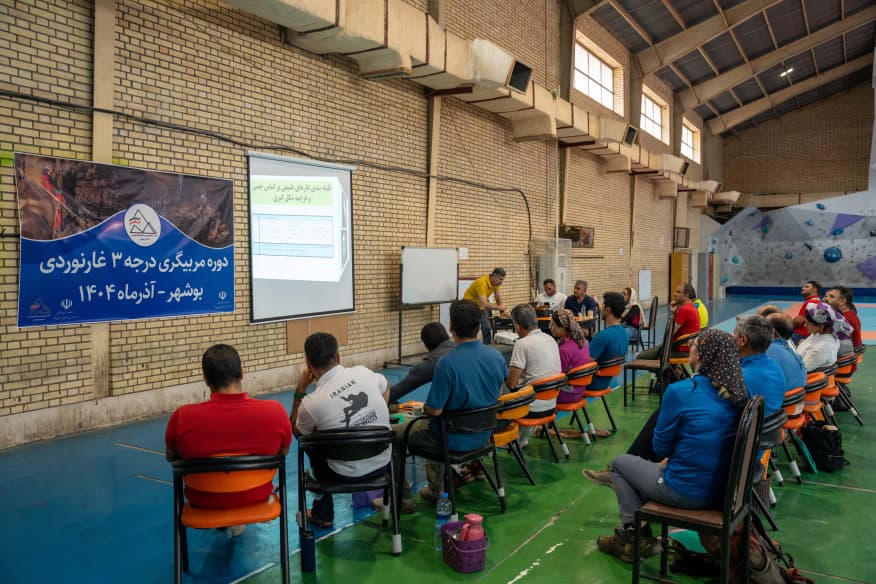
با عنایت به برگزاری دوره مربیگری درجه 3 درهنوردی از تاریخ 29 آبان لغایت 3 آذر 1404، بدینوسیله اسامی قبول شدگان به شرح زیر اعلام میگردد: ...
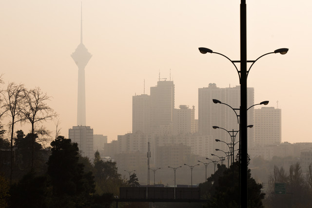
فدراسیون پزشکی ورزشی جمهوری اسلامی ایران با صدور اطلاعیهای خطاب به فدراسیونها، نسبت به افزایش غلظت آلایندههای هوا در هفتههای اخیر هشدار داد و لزوم رعایت دستورالعملهای مراقبتی جهت حفظ سلامت ورزشکاران را مورد تأکید قرار داد.

فدراسیون پزشکی ورزشی جمهوری اسلامی ایران با صدور اطلاعیهای خطاب به فدراسیونها، نسبت به شیوع بیماریهای عفونی فصلی و آنفلوآنزا همراه با آلودگی هوا هشدار داد و بر لزوم رعایت نکات بهداشتی برای حفظ سلامت ورزشکاران و کارکنان تأکید کرد...
ادامه مطلب را ملاحظه نمائید: ...
فایل پیوست را دریافت و ملاحظه نمائید:...
پیرو برگزاری دوره مربیگری درجه 2 غارنوردی مورخ 28 مهر لغایت 2 آبان 1404 در استان قزوین اسامی قبولشدگان به شرح زیر اعلام میگردد:...
اسامی قبول شدگان دوره مربیگری درجه 3 درهنوردی
فراخوان عمومی مشارکت در پویش ملی «بساز مدرسه»
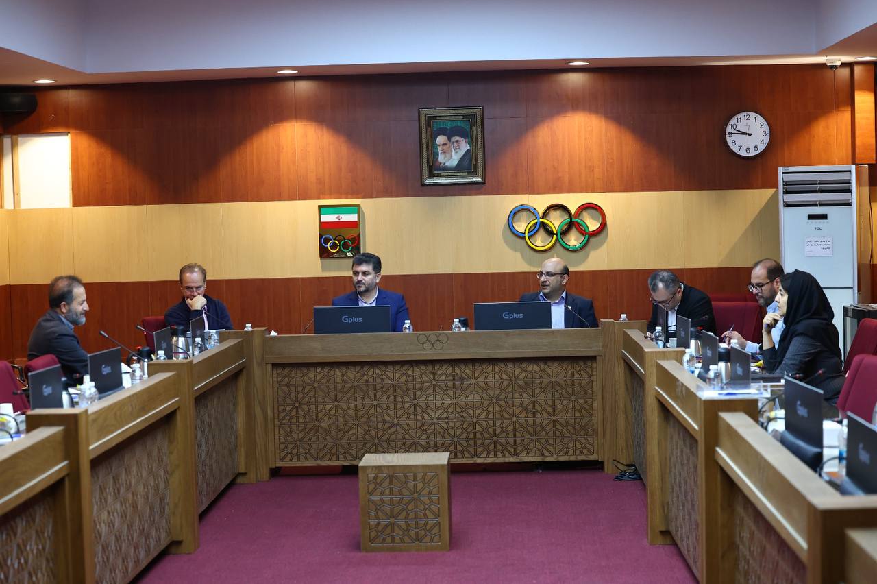
برگزاری نشست کمیسیون طراحی فدراسیون جهانی صعودهای ورزشی
برگزاری نشست کمیسیون رسانه و بازاریابی فدراسیون جهانی صعودهای ورزشی با طرح «ساختن جامعه جهانی صعودهای ورزشی»
نشست کمیسیون حکمرانی فدراسیون جهانی صعودهای ورزشی با محوریت اصلاحات ساختاری و حقوقی
گزارش تصویری / برگزاری دوره مربیگری درجه ۳ غارنوردی
گزارش تصویری / برگزاری دوره مربیگری درجه ۳ غارنوردی
پيش بيني جوي مناطق كوهستاني كشور طي پنجشنبه و جمعه( ١٣ و ١٤ آذر ماه ١٤٠٤)
هشدار فدراسیون پزشکی ورزشی درباره افزایش بیماریهای تنفسی و آنفلوآنزا
ابلاغیه فدراسیون پزشکی ورزشی درباره تشدید آلودگی هوا و توصیههای بهداشتی برای ورزشکاران
اسامی قبول شدگان دوره مربیگری درجه 3 درهنوردی
ابلاغیه فدراسیون پزشکی ورزشی درباره تشدید آلودگی هوا و توصیههای بهداشتی برای ورزشکاران
هشدار فدراسیون پزشکی ورزشی درباره افزایش بیماریهای تنفسی و آنفلوآنزا
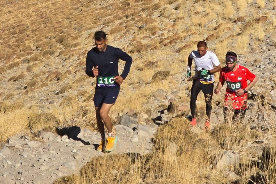
رده بندی کامل ورزشکاران مسابقات دوی کوهستان قهرمانی کشور /تبریز آبان 1404
لیست احکام آماده تحویل / آذر 1404
اطلاعیه پذیرفته شدگان دوره مربیگری درجه 2 غارنوردی
بیست و سومین دوره مسابقات سنگنوردی جام فجر / گرایش سرعت رده سنی بالای ۱۴ سال زنان و مردان - آذر ۱۴۰۴ - تهران
دوره مربیگری درجه ۳ یخ نوردی / ۲۴ آذر 1404
اسامی قبولشدگان دوره مربیگری درجه 2 و 3 سنگ آبان 1404 / استان البرز
فراخوان اولین اردوی غارشناسی / ۱۹ تا ۲۱ آذرماه ۱۴۰۴ / کازرون
اسامی قبول شدگان دوره مربیگری درجه 3 درهنوردی
ابلاغیه فدراسیون پزشکی ورزشی درباره تشدید آلودگی هوا و توصیههای بهداشتی برای ورزشکاران
هشدار فدراسیون پزشکی ورزشی درباره افزایش بیماریهای تنفسی و آنفلوآنزا
رده بندی کامل ورزشکاران مسابقات دوی کوهستان قهرمانی کشور /تبریز آبان 1404
لیست احکام آماده تحویل / آذر 1404
اطلاعیه پذیرفته شدگان دوره مربیگری درجه 2 غارنوردی
بیست و سومین دوره مسابقات سنگنوردی جام فجر / گرایش سرعت رده سنی بالای ۱۴ سال زنان و مردان - آذر ۱۴۰۴ - تهران
دوره مربیگری درجه ۳ یخ نوردی / ۲۴ آذر 1404
اسامی قبولشدگان دوره مربیگری درجه 2 و 3 سنگ آبان 1404 / استان البرز
فراخوان اولین اردوی غارشناسی / ۱۹ تا ۲۱ آذرماه ۱۴۰۴ / کازرون
اسامی قبول شدگان دوره مربیگری درجه 3 درهنوردی
فراخوان عمومی مشارکت در پویش ملی «بساز مدرسه»
برگزاری نشست کمیسیون طراحی فدراسیون جهانی صعودهای ورزشی
برگزاری نشست کمیسیون رسانه و بازاریابی فدراسیون جهانی صعودهای ورزشی با طرح «ساختن جامعه جهانی صعودهای ورزشی»
نشست کمیسیون حکمرانی فدراسیون جهانی صعودهای ورزشی با محوریت اصلاحات ساختاری و حقوقی
گزارش تصویری / برگزاری دوره مربیگری درجه ۳ غارنوردی
گزارش تصویری / برگزاری دوره مربیگری درجه ۳ غارنوردی
پيش بيني جوي مناطق كوهستاني كشور طي پنجشنبه و جمعه( ١٣ و ١٤ آذر ماه ١٤٠٤)
هشدار فدراسیون پزشکی ورزشی درباره افزایش بیماریهای تنفسی و آنفلوآنزا
ابلاغیه فدراسیون پزشکی ورزشی درباره تشدید آلودگی هوا و توصیههای بهداشتی برای ورزشکاران
تسلیت فقدان پدر مسئول کمیته صعودهای ورزشی هیئت استان خراسان شمالی
گزارش تصویری / برگزاری نخستین دوره بازآموزی سراسری طراحان درجه ۱، ۲ و ۳ صعودهای ورزشی در اصفهان
تسلیت فقدان تأثرانگیز «محسن اسدنیا» از مربیان و داوران کوهنوردی و صعودهای ورزشی
برگزاری سومین دوره بازآموزی سراسری مربیان درجه ۳ صعودهای ورزشی در بجنورد – خراسان شمالی

برگزاری نشست کمیسیون طراحی فدراسیون جهانی صعودهای ورزشی
برگزاری نشست کمیسیون رسانه و بازاریابی فدراسیون جهانی صعودهای ورزشی با طرح «ساختن جامعه جهانی صعودهای ورزشی»
نشست کمیسیون حکمرانی فدراسیون جهانی صعودهای ورزشی با محوریت اصلاحات ساختاری و حقوقی
انعقاد تفاهمنامه میان فدراسیونهای کوهنوردی ایران و افغانستان
تسلیت فقدان پدر مسئول کمیته صعودهای ورزشی هیئت استان خراسان شمالی
گزارش تصویری / برگزاری نخستین دوره بازآموزی سراسری طراحان درجه ۱، ۲ و ۳ صعودهای ورزشی در اصفهان
تسلیت فقدان تأثرانگیز «محسن اسدنیا» از مربیان و داوران کوهنوردی و صعودهای ورزشی
برگزاری سومین دوره بازآموزی سراسری مربیان درجه ۳ صعودهای ورزشی در بجنورد – خراسان شمالی
برگزاری نشست کمیسیون طراحی فدراسیون جهانی صعودهای ورزشی
برگزاری نشست کمیسیون رسانه و بازاریابی فدراسیون جهانی صعودهای ورزشی با طرح «ساختن جامعه جهانی صعودهای ورزشی»
نشست کمیسیون حکمرانی فدراسیون جهانی صعودهای ورزشی با محوریت اصلاحات ساختاری و حقوقی
انعقاد تفاهمنامه میان فدراسیونهای کوهنوردی ایران و افغانستان